

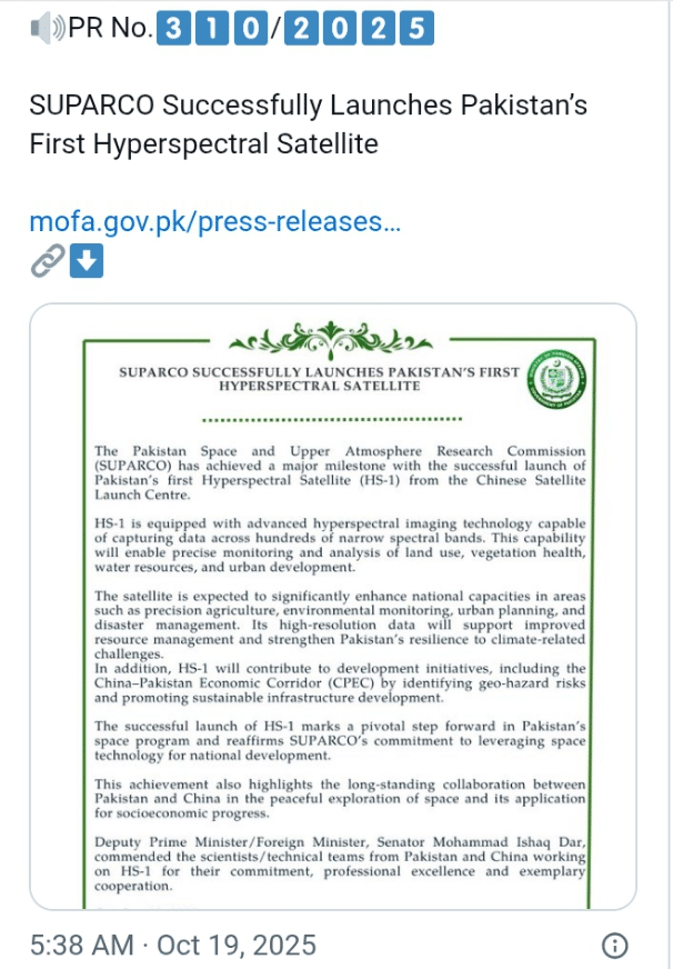
Pakistan has achieved a defining milestone by launching its first-ever Pakistan hyperspectral satellite, an achievement hailed as a strategic advancement in science, technology, and regional cooperation.
Officials from the Space and Upper Atmosphere Research Commission (SUPARCO) confirmed that the satellite, designated H1, was launched from China’s Jiuquan Satellite Launch Centre early Sunday morning, signifying a turning point in satellite technology in Pakistan.
The Pakistan hyperspectral satellite is expected to transform the nation’s capacity for precision agriculture, urban planning, and disaster response, empowering decision-makers with advanced imaging data for sustainable development.
“The data from this satellite will revolutionize our understanding of environmental dynamics, crop monitoring, and water management,” said SUPARCO chairman Muhammad Yousuf Khan in a televised statement from Karachi.
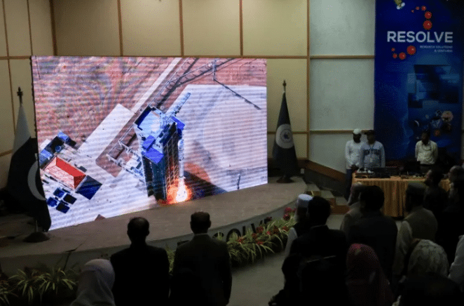
Khan described the Pakistan hyperspectral satellite as a “pivotal step toward self-reliance in space-based research,” emphasizing how the country seeks to leverage its technical collaboration through China-Pakistan space cooperation.
According to SUPARCO, hyperspectral imaging enables detection of minute material and chemical variations, giving scientists deeper insights into soil conditions, vegetation health, and disaster impact assessment.
The launch is the culmination of over five years of design and testing between Pakistani and Chinese engineers, illustrating the growing synergy under China-Pakistan space cooperation programs.
“This marks a proud moment for both nations,” stated a spokesperson from China’s National Space Administration, “as we strengthen peaceful space exploration aimed at mutual socioeconomic progress.”
The Pakistan hyperspectral satellite was developed through a bilateral agreement under which Chinese launch facilities would assist in Pakistan’s advanced imaging projects, similar to previous cooperative satellite missions.
Experts in satellite technology in Pakistan noted that the system can capture up to 300 spectral bands, providing fine-grained earth observation crucial for national infrastructure and CPEC development projects.
The Ministry of Foreign Affairs called the launch “a major stride in strengthening Pakistan’s technical independence,” adding that the Pakistan hyperspectral satellite would “significantly enhance national capacities.”
Analysts say the timing of this launch coincides with Islamabad’s push to rebuild public confidence in science and governance after years of economic and political instability.
“This satellite demonstrates a commitment to innovation and resilience,” remarked Dr. Saima Zafar, an aerospace analyst. “It is not merely a machine—it represents a vision of Pakistan’s future in technology.”
For Pakistan, the Pakistan hyperspectral satellite carries both symbolic and strategic importance, showcasing the country’s intent to align scientific ambition with sustainable growth priorities.
In particular, it strengthens Pakistan’s role within China-Pakistan space cooperation, a framework that has expanded under the broader China-Pakistan Economic Corridor (CPEC) and Belt and Road Initiative.
According to SUPARCO officials, hyperspectral data will assist in resource mapping, urban heat tracking, and natural hazard forecasting—key tools for improving decision-making in climate-vulnerable regions.
“The imagery will help us identify deforestation patterns, monitor glaciers, and plan better irrigation systems,” explained an environmental researcher affiliated with the Pakistan hyperspectral satellite program.
Pakistan’s agricultural sector, which employs nearly 40 percent of the workforce, stands to benefit enormously as the Pakistan hyperspectral satellite introduces high-resolution land data for crop optimization.
Beyond farming, authorities said that satellite technology in Pakistan would support flood prevention, pollution detection, and land-use mapping in megacities like Karachi, Lahore, and Islamabad.
The Ministry of Planning said that integrating hyperspectral imaging into CPEC development could improve the environmental sustainability of road and energy projects across the corridor’s routes.
“It’s about managing growth intelligently,” said a government adviser. “The Pakistan hyperspectral satellite will ensure that development along CPEC aligns with ecological balance and long-term national goals.”
The H1 satellite joins EO-1 and KS-1, two other systems that SUPARCO launched earlier this year, signaling the most active phase in Pakistan’s space programme to date.
Engineers say it will take nearly two months to calibrate the Pakistan hyperspectral satellite, after which it will begin transmitting data to ground stations in Karachi and Rawalpindi.
The images, once processed, will be shared across research institutions, ministries, and industries, establishing the foundation of a modernized data-driven planning infrastructure.

“This is a pivot from dependency to autonomy,” said science policy expert Farooq Ahmad. “The Pakistan hyperspectral satellite ensures Pakistan can monitor its land and resources without relying on foreign imagery.”
The Pakistan hyperspectral satellite is also being seen as a confidence booster for local scientists, many of whom have long called for higher investment in research and education.
Khan emphasized that SUPARCO plans to train hundreds of young engineers through collaborations with universities, integrating the Pakistan hyperspectral satellite data into national academic research.
China, for its part, reiterated its “complete support for Pakistan’s peaceful space ambitions,” underscoring the depth of China-Pakistan space cooperation in advancing shared technological progress.
The project aligns with China’s strategy to expand its space diplomacy through scientific collaboration, fostering stability and partnership in Asia’s emerging technological landscape.
“The partnership transcends borders,” said a senior Chinese engineer involved in the launch. “The Pakistan hyperspectral satellite is proof of cooperation rooted in trust and mutual development.”
Officials believe the satellite will enable better coordination during disasters such as floods, earthquakes, and droughts, which frequently threaten Pakistan’s infrastructure and economy.
By combining hyperspectral imaging with existing communication satellites, SUPARCO expects to create an integrated national space observation system within the next five years.
Experts have pointed out that while Pakistan still lags behind regional space powers like India, the Pakistan hyperspectral satellite places it firmly on the map of modern space nations.
In contrast to previous ventures focused on communications, this satellite adds scientific depth, expanding the country’s influence in data analytics and climate monitoring.
For many observers, the Pakistan hyperspectral satellite is more than an achievement—it’s the country’s declaration of intent to join the digital and spatial revolutions shaping global development.
“Access to our own spectral data means control over national priorities,” said climate policy analyst Raza Mehdi. “It reduces external dependence and enhances transparency.”
The economic implications are also significant. By using locally generated satellite data, Pakistan can save millions in annual imports of remote-sensing imagery from foreign agencies.
Through effective data utilization, satellite technology in Pakistan can become a foundation for a thriving geospatial economy, supporting agriculture, transport, and environmental sectors.
International observers have commended Pakistan’s move as “a responsible and peaceful expansion of space capacity,” contrasting it with regional military-driven satellite races.
As one Western diplomat noted anonymously, “The Pakistan hyperspectral satellite illustrates that cooperation, not competition, defines South Asia’s next frontier in science.”
Nevertheless, experts caution that maintaining the satellite’s precision requires consistent funding, advanced ground infrastructure, and institutional stability within SUPARCO.
“The mission’s success depends on continuity,” remarked Dr. Aisha Nadeem, a space systems consultant. “The Pakistan hyperspectral satellite is a beginning, not the endgame.”
Indeed, Pakistan’s endgame involves weaving space technology into every layer of national governance—from rural development to urban resilience and environmental justice.
That vision ties closely to CPEC development, as hyperspectral mapping ensures that infrastructure projects proceed with sustainable oversight and minimal ecological disruption.
Khan hinted that Pakistan may soon explore joint missions with other nations under the umbrella of China-Pakistan space cooperation, expanding its scientific diplomacy footprint.
The government also plans to use hyperspectral data for cross-border resource management, helping resolve regional water and agricultural disputes through transparent scientific evidence.
As the Pakistan hyperspectral satellite stabilizes in orbit, national pride resonates across social media, where scientists and citizens alike celebrate the dawn of a self-reliant technological era.
For a country often defined by political turbulence, this scientific achievement reinforces a different narrative—one of intellect, collaboration, and forward momentum.
In the coming years, satellite technology in Pakistan may evolve into a cornerstone of its foreign policy and economic planning, bridging science with diplomacy and sustainability.
The Pakistan hyperspectral satellite thus embodies both aspiration and responsibility, symbolizing how space innovation can guide a nation toward balanced, knowledge-driven program.
About The Author